Terrain Avoidance Quick Guide#
There's already quite a long article on mwp's terrain analysis tool; this is a quick summary of how to use it in three steps.
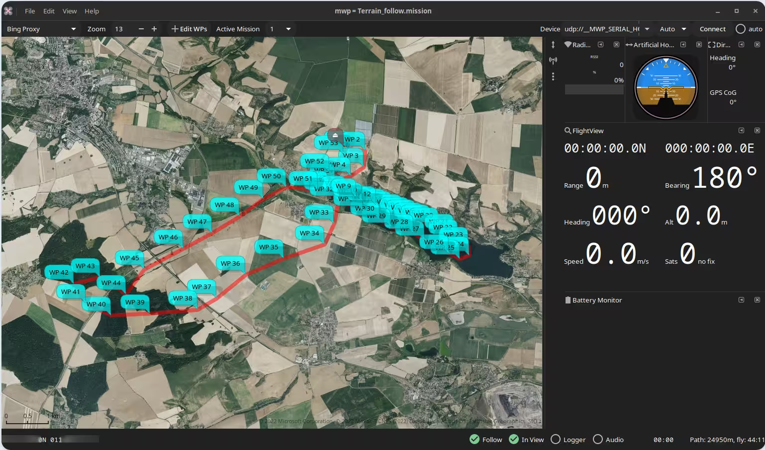
1. Load your mission#
First load (or create) the mission in mwp. Here, the pilot chooses to take a cruise around the lake and adjacent country side. The brown / grey icon at the top of the mission is the planned home location. At first glance, the terrain looks quite benign.
2. Set your avoidance parameters#
By right clicking on any waypoint, we can select Terrain Analysis. No internet connection is required if you already have cached imagery and DEM tiles.
- Home is taken from the planned home location
- The pilot elects for 30m clearance above terrain
- Uses the same altitude definition (Relative / Absolute) as is set in the extant mission
- Replace the mission altitudes with the altitudes generated from the analysis
- Highlight any extreme climb / dive angles
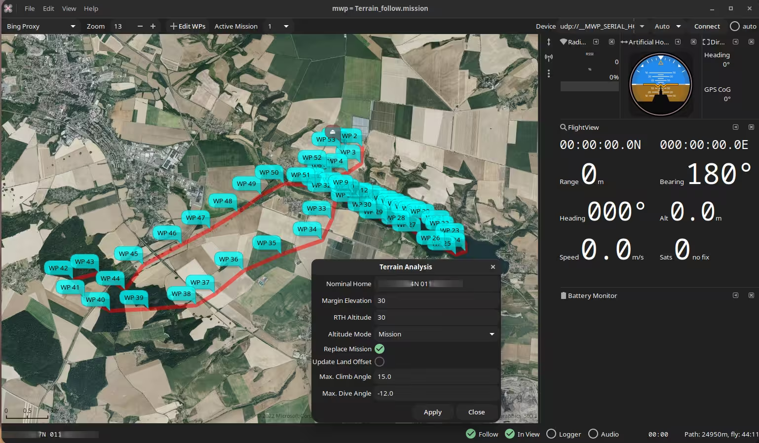
On clicking Apply, the analysis will run.
3. Review the output#
The output is displayed as a chart of the terrain (green), the original mission (red), the avoidance margin (blue, 30m in this example), and the adjusted mission (orange). There is also a Climb / Dive analysis.
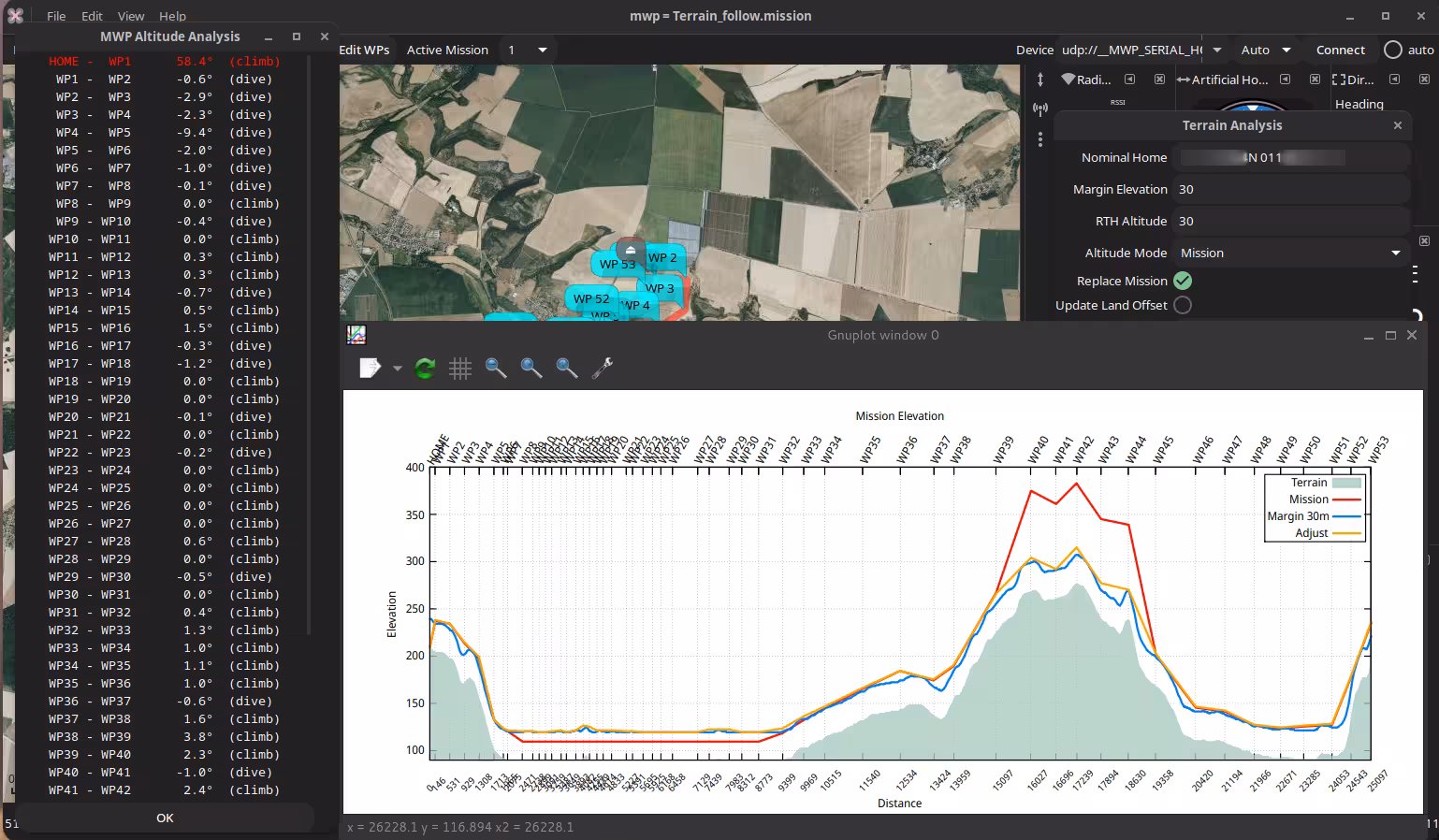
There are a few places that could benefit from further manual adjustment, but in general it looks pretty good.
- We could eliminate the unnecessary small dips at WP37, WP41 and WP43
- It is unlikely we'll try the extreme climb from HOME to WP1; the mission will probably be invoked some distance from home.
So it looks good. Or does it?
Terrain may not be the only hazard#
The terrain analysis is only as good as the terrain data. If we zoom in closely, or look at a difference map source (e.g. OpenTopo), or examine the route in 3D (Google Earth) via flightlog2kml / mission2kml, maybe from fl2xui we can see another hazard. Between WP36-WP37 and WP47-WP48 there are high voltage overhead transmission lines. Hitting these, or at WP48, the tower would be sub-optimal.
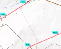
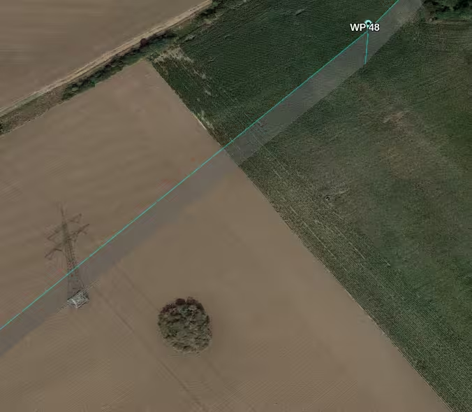
A re-plan seems like a good idea, at least adding significant altitude on these legs of the mission.